
|
|
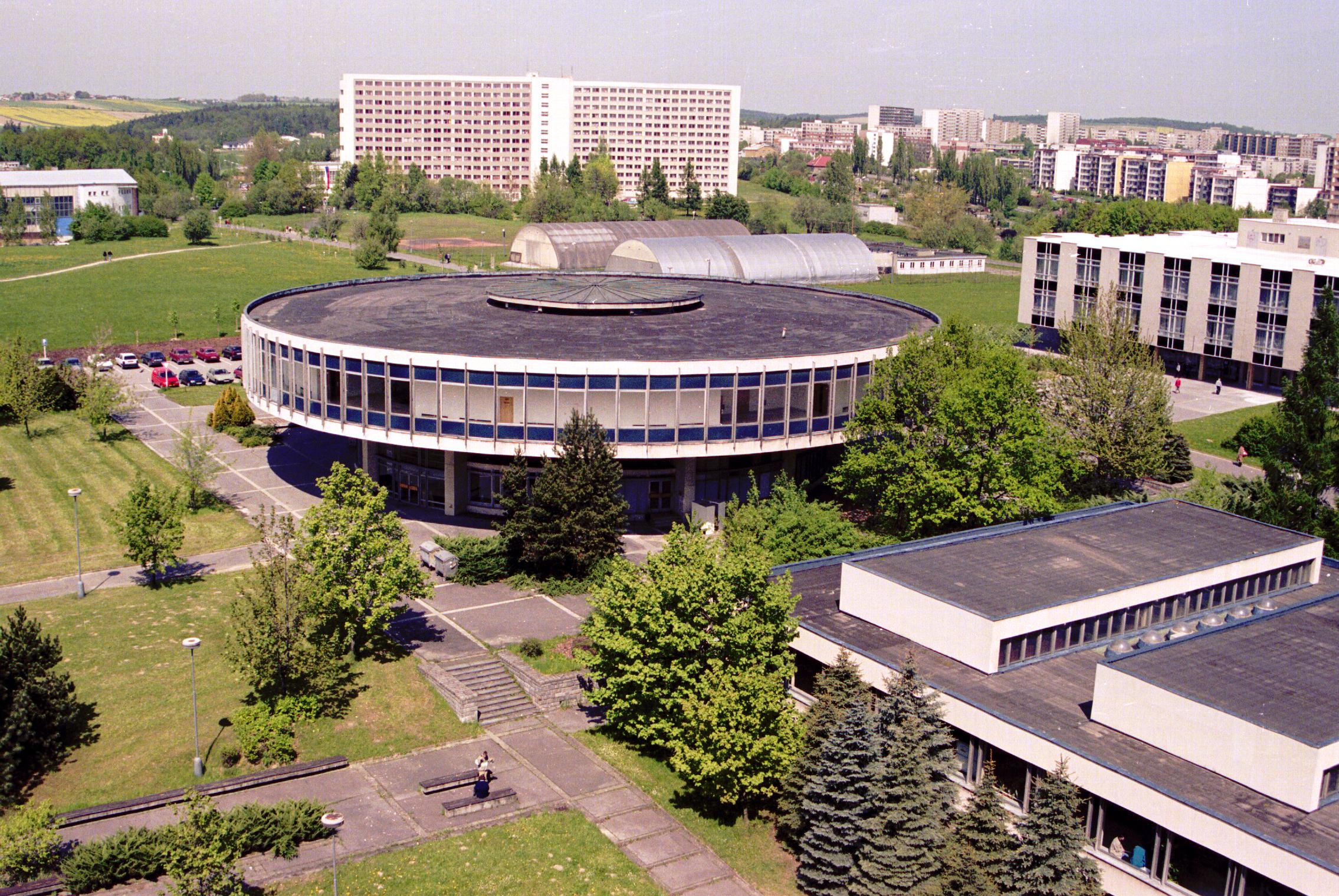
ICEE '99 Conference,
|
Czech Republic |
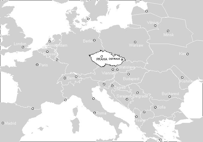
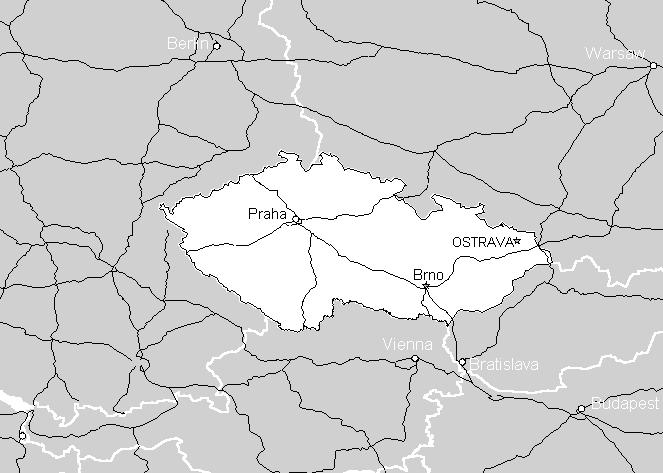
The Czech Republic is situated approximately in the geographical center of Europe and has an area of 78,866 sq. km. It is a landlocked country 326 km from the Baltic and 322 km from the Adriatic. It shares borders with Germany (810 km), Poland (762 km), Austria (466 km) and Slovakia (265 km). The highest point of elevation is the peak of Mt. Snezka (1,602 m above sea level) and the lowest point of elevation is near Hrensko where the River Labe leaves Czech territory (117 m above sea level).
| National Flag | National Seal |
 |
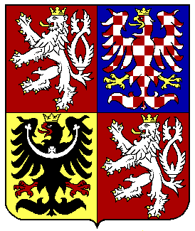 |
The three original lands of the Czech Crown are represented on the national seal by three crests:
a lion with two tails representing Bohemia, a red-and-white chequered eagle representing Moravia and a black eagle bearing a silver crescent representing Silesia.
National Anthem: Kde domov muj (Where is my Home) ![]()
![]()
Area: 78,886 sq.km
Capital: Prague (Praha) (Population: 1,213,800)
Length of state border: 2,303 km
Population: 10,304,302
Population density: 131 inhabitants/sq. km
Time zone: Central European Time (C.E. T .)
Political system: Parliamentary democracy
Currency: Koruna (Kc) - Czech crown (CZK) Czech banknotes (pictures) (1 USD = 35.5 CZK, May 3, 1999) CNB
Prague |
Prague is the capital of the Czech Republic and lies in the middle of Bohemia. It covers an area of nearly 500 sq kms and its population is about 1.2 millions. Prague is divided into many boroughs. The historical centre is made up by Old Town, Josefov , the Lesser Quarter, Hradcany , the New Town and Vysehrad. Together they make a town which is quite unique.
The oldest settlements of this region dates back 25 000 years. In the latter half of the 10th century St. Vitus Rotunda, the Prince's Palace and a convent with a church were built on Hradcany.
Prague became the imperial residence of Charles IV. An archbishopric, Charles University, the New Town with the Horse Market (now Wenceslas Square) and the Cattle market (now Charles Square) were founded. Charles IV promo-ted the construction of other important buildings such as St. Vitus Cathedral and the Charles Bridge.
Prague is the seat of our President, the Czech government, all important state ministries and the Czech Parliament. It is also an important industrial and business centre and transport crossroad. It is an industrial centre for engineering, food industries, ready-made garments, chemical, polygraphic industries, tourism.
It is also the cultural centre of the Czech Republic. We find the best theatres, galleries and museums here.
Wenceslas Square - the centre of the city . The statue of the Czech patron - St. Wenceslas - made by J. V. Myslbek, is a symbol of a free and independent republic. People have usually gathered here in troublesome moments of Czech history.
The Vltava River flows through Prague and surrounds 7 islands. About 18 bridges stretch over the river.
Ostrava |
Ostrava is the administrative, economic and cultural centre of the largest industrial region in the Czech Republic. With its 330 thousand inhabitants, and area of 214 sq kms, it is the third largest city in the Czech Republic.
The most significant primeval locality discovered here is a mammoth hunters' site on Landek Hill in Ostrava - Petrkovice, it dates back to the Old Stone Age. Archaeological excavations on this site have brought extremely important discoveries: the very first use of hard coal by men, who enjoyed the heat of coal burning in their fireplaces as long as 25 thousand years ago. Also a hematite torso of a woman found in the same site ranks among the most prettily shaped figures of Venus and represents one of the most remarkable achievements of primeval art.
Documents about new settlement in Ostrava region date back to 10th century and are connected with the Slavonic tribe. In the first half of the 13th century Ostrava became the property of the bishop of Olomouc and this community was given the statute of a town in 1267. During 14th century the town was grated some trade privileges, and it was fortified with a wa1l. In the 18th century hard coal deposits were discovered and this coal became the basis of further development of the town. Modem ironworks were built in Vitkovice, which enforced the construction of a railway connecting Ostrava to the Wien - Krakow railway in 1847 . Industrialization in 19th century changed this former agricultural and artisans' town very much. Mines, machine works and chemical plants were founded there.
Ostrava lies on the confluence of four rivers - Ostravice, Lucina, Opava and Odra. Some of the most significant buildings are New Town-ha1l with a sight-seeing tower which is 85 m high; St. Wenceslas gothic church, Old town-ha1l (it is the seat of town museum); Divine Saviour's Cathedral, Antonin Dvorak Theatre (from 1907) and Jiri Myron Theatre (from 1894). Business and Bank buildings make up for the modem architecture coming from the period between Wor1d Wars.
In spite of the fact that a lot of heavy industry has been a part of the town landscape, modern Ostrava is a clean town with many parks and it is situated in wonderful hi1ly countryside with many old castles and chateaux, and close to the wonderful Beskydy and Jeseniky Mountains.
Design © 1999 Radim Farana, Department of Control Systems and Instrumentation